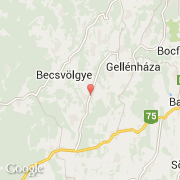
Localidad de Petrikeresztúr (Nyugat-Dunántúl)

hungria

Informations

Cifras

Código del país :
HU
Código postal :
8984
Latitud :
46.73704
Longitud :
16.72445
Huso horario :
Europe/Budapest
Universal Time :
UTC+1
Horario de verano :
Y

La localidad de Petrikeresztúr pertenece (de mayor a menor) a la región Nyugat-Dunántúl y al condado Zala.

Ciudades próximas

  • Gombosszeg ~2 km
  • Iborfia ~2 km
  • Barlahida ~3 km
  • Ormándlak ~3 km
  • Pálfiszeg ~5 km
  • Becsvölgye ~4 km
  • Zalatárnok ~5 km
  • Lickóvadamos ~4 km
  • Nagylengyel ~5 km

El transporte en Petrikeresztúr

Otro medio de transporte
Sármellék International Airport ~34 km
Booking.com

Únete a nosotros !

¿Te gusta? Compártelo!