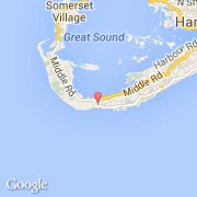
B
- Bay View Drive
- Beaming Hill
- Benevides Lane
- Benny's Bay Road
C
- Camp Hill
- Cattle Lane
- Cedar Hurst Place
- Cedar Lane
- Church Road
- Cliff Crescent
- Colony Lane
- Colony Valley
- Coral Acres Drive
- Corn Cob Alley
- Cross Bay Road
- Crown Hill
G
- Garden Path
- Gibbs Hill Road
- Granaway Drive
- Granaway Heights Road
H
- Ha'Penny Lane
- Hampton Head Court
- Harbour View Drive
- Hawthorn Lane
- Heron View Lane
- Herons Nest Drive
- High Point Lane
- High Point Road
- High View Lane
- Hightime Drive
- Hilltop Court
- Hilltop Drive
- Homestead Lane
- Horseshoe Close
- Horseshoe Road
L
- Landmark Drive
- Leacraft Hill Road
- Letitia Drive
- Lighthouse Lane
- Lighthouse Road
- Littleholme Lane
- Lukes Pond Drive
- Lukes Pond Road
P
- Peppercorn Lane
- Pie Crust Place
- Pinetree Avenue
- Plumber Lane
- Pompano Beach Road
- Pompano Lane
- Port Royal Gardens
- Port Royal Golf Course Road
- Port Royal Hill
- Port Royal Lane
- Port Royal Mews
- Prism Heights
R
- Raynor Heights
- Raynor's Drive
- Rebecca Road
- Riviera Crescent
- Riviera Road
- Rock Sound Road
- Rockywold Drive
- Rockywold Road
- Rose Hill Road
S
- Sandycroft Heights
- Sandycroft Lane
- Scenic Heights Drive
- Scenic Heights Lane
- Scenic Heights Pass
- Scenic Lane
- Scenic Place
- Sea Swept Farm
- Sentinel Hill
- Seymour Farm Road
- Shawn Acres Lane
- Sinky Bay Road
- Sonesta Drive
- South Avenue
- South Road
- Southampton Road
- Southdown Close
- Southdown Road
- Spring Benny Drive
- Spring Benny Lane
- Spring Benny Road
- St Anne's Close
- St Anne's Drive
- St Anne's Road
- Sunnylea Lane
- Sunnyside Park Drive
- Sunnyside Park Lane
T
- Tribe Road #1
- Tribe Road #2
- Tribe Road #3
- Tribe Road #5
- Tribe Road #6
- Turtle Bay Crescent
- Turtle Bay Drive
- Turtle Bay Lane
- Turtle Place
W
- Whale Bay Road
- Whaling Hill
- Whaling Lane
- White Hill View
- Williamsville Place
- Woodlawn Road


